We were glad to exit the crazy Palermo traffic this morning and get out of the city. Although even the few kilometres we had to transit were pretty fraught. Lanes are pretty optional and the more beaten up the car the more aggressively they drive. However, we escaped unscathed, happy to take the dual carriageway route out of town with its nice wide painted lanes. If it wasn’t for the gusting broadside winds, it might not have been a bad drive. However, it was much worse for the overcab bedded camper behind us fighting his way off the hard shoulder in the elevated sections of the road 😨.
Already Sicily appears much more populous than Sardinia, many more houses and much more of the land is cultivated from what we have seen so far. The population of Sicily is just short of 5 million, more than treble that of Sardinia, with only 7% more land mass (25,711km2). It looked a little more arid around Palermo, but has become more green as we have headed further west to the windward side of the island.

Today’s destination was Segesta, renowned for its temple but also containing the ruins of a Greek amphitheater, city walls, church, castle and the house of Navarch Heraclius, commander of the Segesta naval fleet. Additionally the site of the first confirmed Mosque on Sicily as another example of the multiple civilisations which have colonised these lands. The temple was built in 430 BC and although it has Hellenic influences, likely from employed Greek designers and workers it pre-dates the Greek era, being built by the Elimi people of Anatolian (Turkish) origin. The temple itself was never actually completed, it is hypothesised that there was never a roof due to the invasion by the Carthaginian’s which occurred during its construction. The temple is built on the top of a hill across a valley from what was the city of Segesta. Segesta and nearby Erice, where we are spending tonight, are believed to have been founded in 9th century BC by Trojan refugees becoming the Elimi people, although this is not backed by archeological evidence.

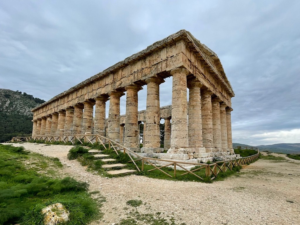

We visited the temple first, a towering building, in a beautiful rural setting. We had the place to ourselves as we walked around. There is much weather damage to the 36 limestone columns, each 10 meters high, however the structure is amazingly well preserved considering it’s 2400+ year age. I wondered as we walked around whether the ancient builders depicted on the artist impression on their wooden scaffolding had any concept of the 100 generations which would see their work to the current day and how many more may yet do so.
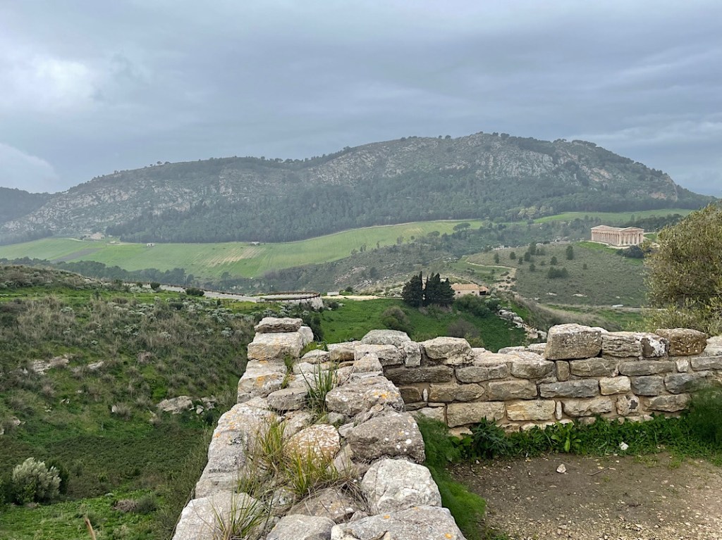
We then walked down the temple hill to walk up the hill where the city of Segesta once stood. This hill is higher and more defensively strategic, with cliffs and a ravine on three sides. The one valley entry route to the city was bricked up with a city gate which we visited first. It had been pretty extensively renovated, including the addition of an RSJ to the rear. However, by the looks of the rickety wooden bridge beside, few people bother to walk down the side path to this spot, certainly the majority of visitors today took the bus option to the top to see the amphitheater.
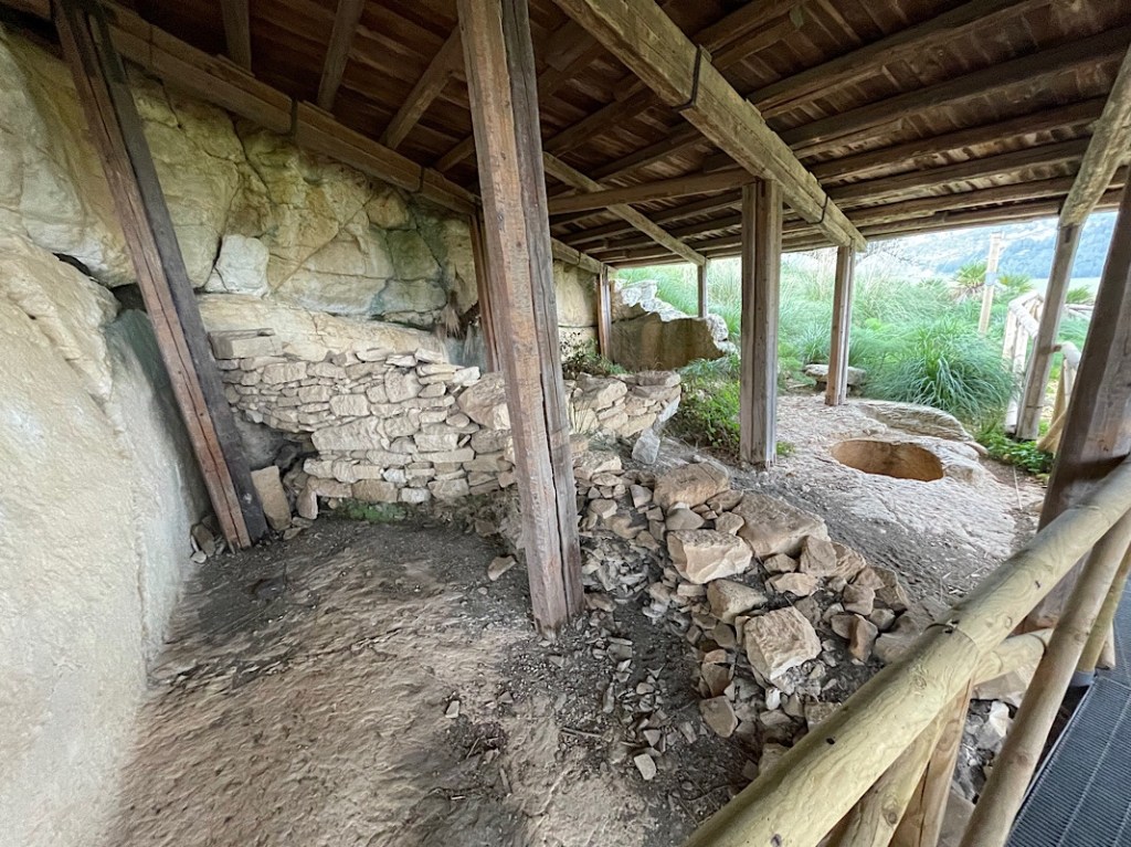
Our more inquisitive route up the hillside had us pushing through brambles on a narrow path that lead an assault up to the old city walls, just within which an original dwelling house carved out of the rocks could be visited, with what appeared to be the fireplace and well inside.

We then crested the hill to reach first what was apparently a gymnasium dedicated to the education of the city’s youth, based on inscriptions found on the floors. Although to be honest, the actual remains and lack of information boards in this area made that hard to discern. There was also a Bouleuterion, or assembly hall added during the Hellenic / Roman era for the governing of the city, believed to have originally held 200 people. A church and castle remains were also added in this area in the Medieval era (around 1442).
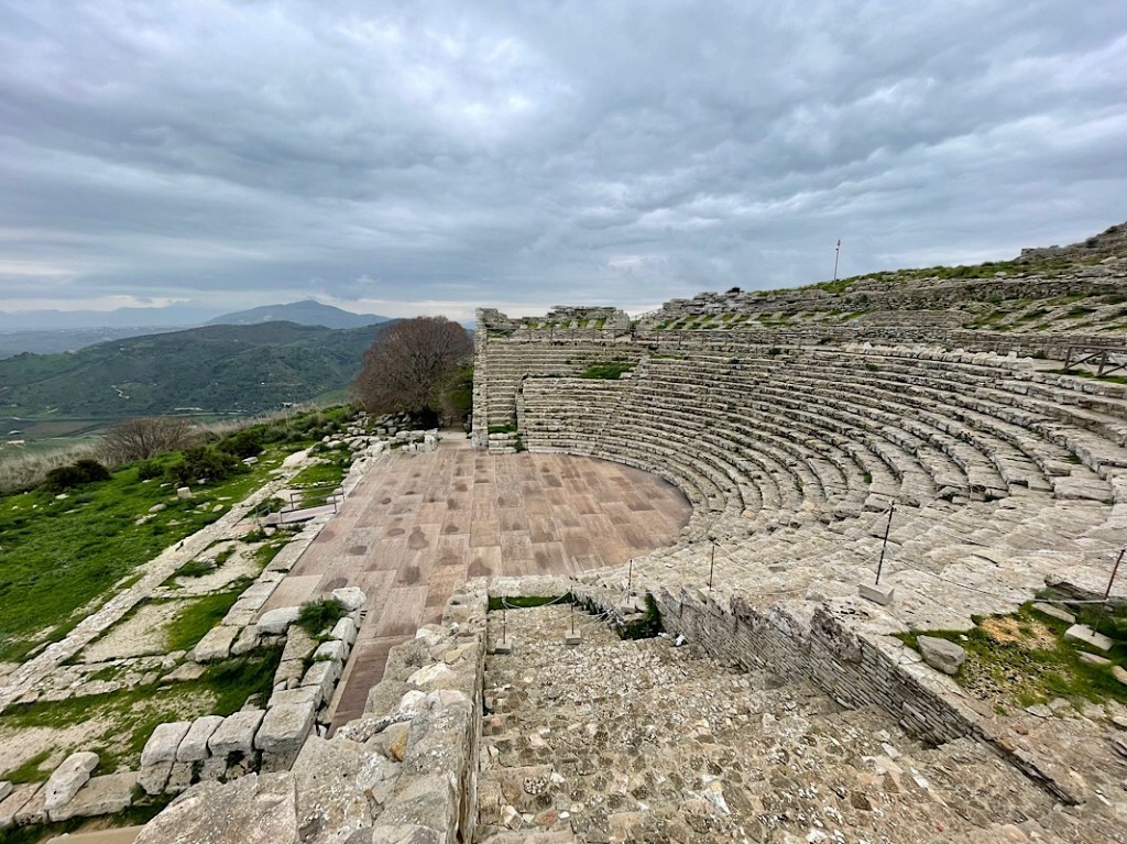

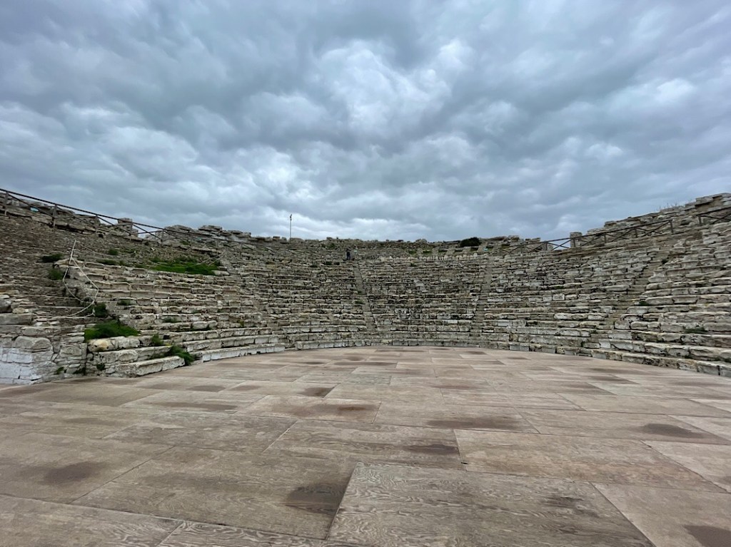
Finally we stepped over the crest of the hill to the Greek amphitheatre added during the 2nd century BC, but later the stage and orchestra area were enlarged by the Romans. It was by far and away the most restored of the ruins as it is used for concerts in the summer (EU funding flags proudly displayed), the attendees sitting on the same stone seats as it’s original occupants over 2000 years ago. That’s a pretty impressive bit of construction. The floor has been boarded and the stones clearly reseated, in phases based on the stone restoration dates built into them, however it preserves the use of the structure into another era. The views, even in the thick cloud we had today were stunning right out across the countryside. It must be a wonderful setting to watch a performance.


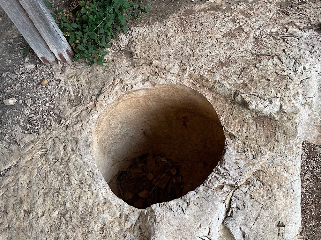
The final part of the site on the other side of the hill on its own circular path were the remains of the house of Navarch Heraclius, which according to our pocket guide had a Greek welcome inscription on the threshold and a main hall decorated with a mosaic. We saw none of these, only a few random pieces of columns strewn around and part of a floor in an area which appeared abandoned without the usual access controls etc. We saw an ancient looking stone built well with a fig tree growing out of it, sadly the funding for these parts of the site obviously not maintaining it as required. However the views were stunning out to the North West and the abundant wild fennel made it a really aromatic walk, again having the place to ourselves.
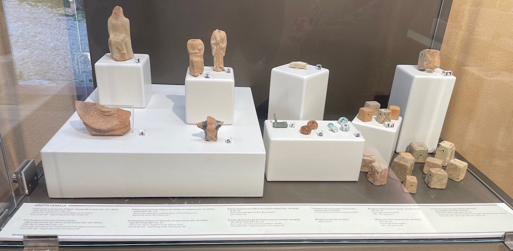


Finally we passed the Antiquarium containing some of the artefacts found on site. So often when we have visited ancient sites the artefacts have been sequestered away to some museum many miles away, it was really good to seem them on site, as it gave a much more human feel. Apparently many were found in a “dump” found at the base of the hill on one side. The pottery patterns etc look like new, mind boggling some of these are 2400+years old.
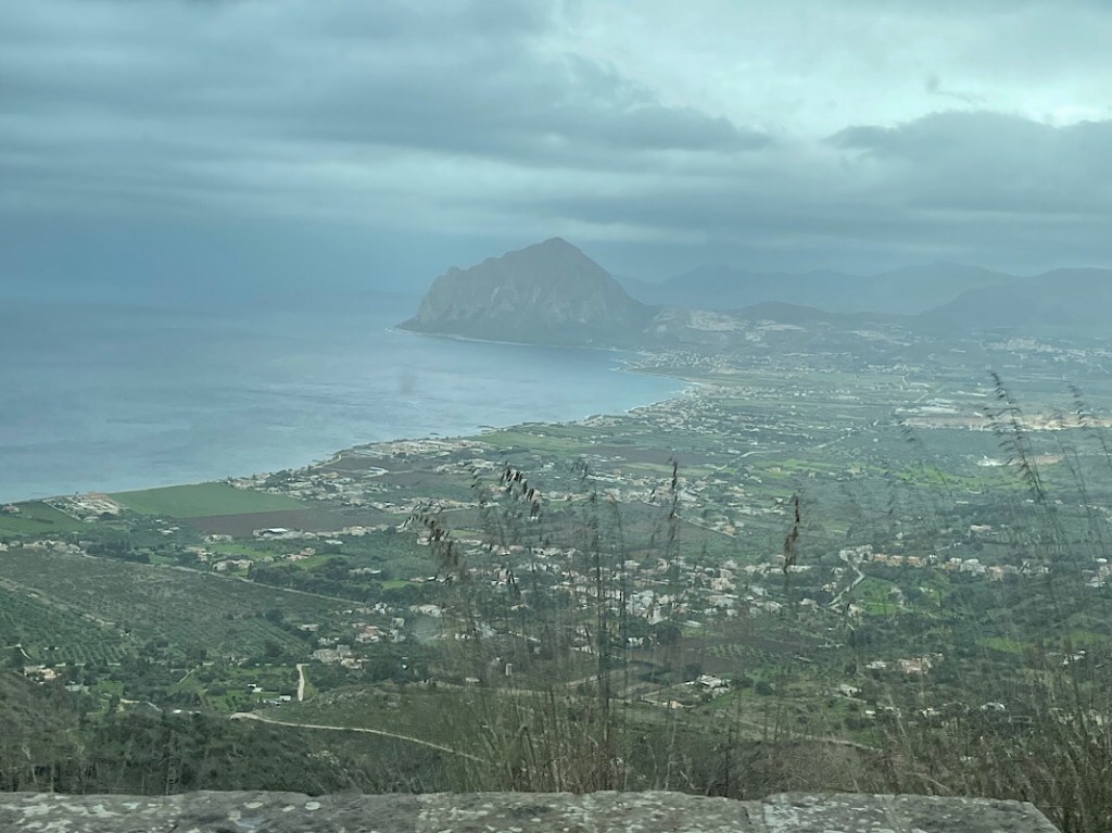


As it was only early afternoon, we decided to press on to Erice for tonight. A fortified town on the top of Monte Erice, at an altitude of 750m / 2460ft. Our parking spot is right at the top, although a cable car does link the upper and lower towns, we drove up. We enjoyed some magnificent views to the west of Capo San Vito, however, after we tried our first park up, where even with ramps we could not get level, the clouds and rain descended around us. We are now parked up in a panoramic viewing spot with two other vans by one of the city gates, but we can only see about 30 ft in front of us! Hopefully we will be rewarded by clear skies and a stunning view when we wake up. Although the switch-back route up the hill was pretty vertigo inducing, so perhaps not too vertiginous would be good!