Start Elevation = 1260, Finish Elevation = 2060m
This morning’s job was to fully stock up on supplies before we head to the mountains for some camping. So grey water was dumped at drainage at the aire we were staying. Groceries from the Carrefour down the road. We thought we could get LPG there but it turned out it was E85 we saw on the sign, an 85% ethanol fuel you can buy here in France. However we did manage to get diesel. The trusty myLPG.eu app found us a Total Energies station on the way out of town. A bit of manoeuvring by Kev to get us the right way round for the pump off at the side of a busy forecourt. Not least because they don’t officially let you refill bottles so better if the opening of the cabinet is more discreet.
Next we needed water and to empty the toilet cassette as both of these services were not working at last night’s aire, even if some used it anyway 🤢. This time Park4Night App showed that the aire in the next village also had broken service point but La Salle-les-Alpes the pretty little ski resort village had one working. We pulled up at the point 2 seconds after a German van but luckily there were two water taps. Phew, all jobs done in 5 stops.
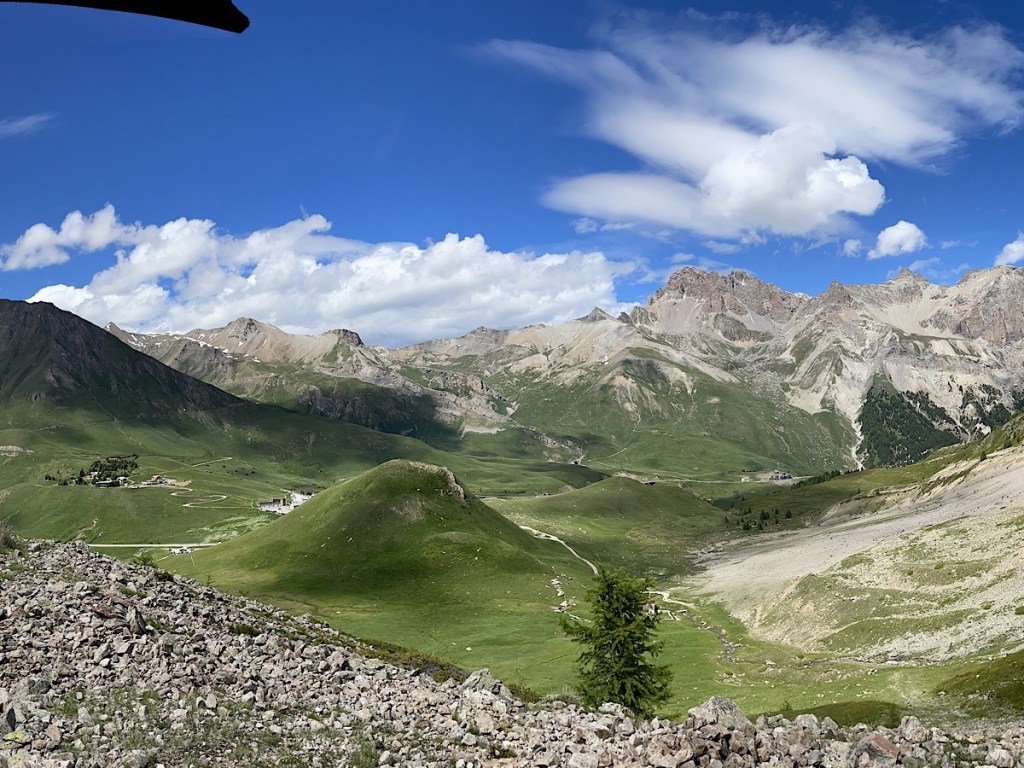
By now we are fully into the winter ski zone. There are stationary ski-lifts heading up into the green hills around us, the route through the trees looking infeasibly narrow and steep for skiing without their snow covering.
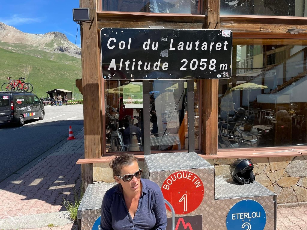
A mere 18km along the Route des Grand Alpes takes us to our destination for this today a motorhome parking spot on the Col du Lautaret at 2060m elevation. As we start on the final ascent though I spot a large yellow sign saying that the Col de Galibier, our plan for tomorrow will be closed then and the next day. Drats. Not sure if this is for cycle racing or roadworks. We decide to continue to Col du Lautaret and find out there.
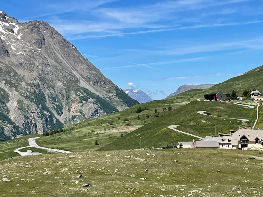
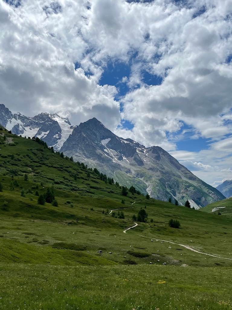
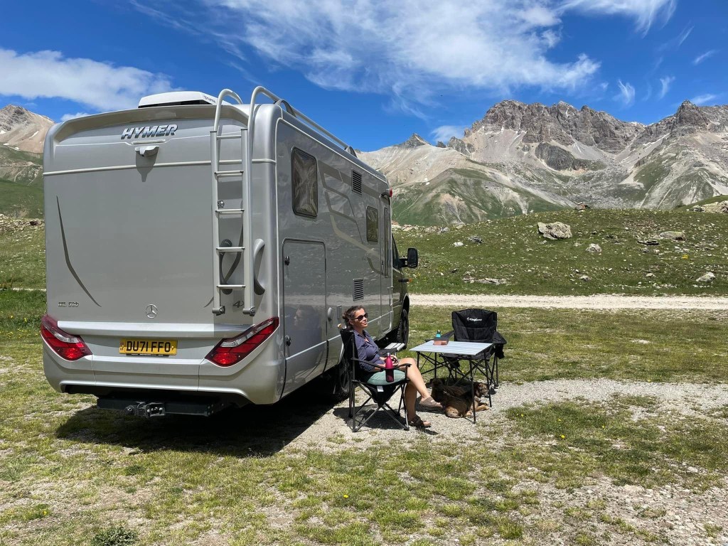
The drive up through the valley is stunning, finally we are amongst the snow tops of the Alpes. As we turn the final bends to the hamlet of Le Lautaret on the top of the Col where a hotel and a couple of cafes have sprung up to service the many cyclists, motorcyclist, sports cars and motorhomes who head up this way in the summer. The hamlet is crowned by the Glacier de la Meije which dominates the views. It is kept open all year round, but I would imagine even the impressively fit cyclist we have see up here who hop off their bikes at the top as if they have just popped to the paper shop may not come up here in the winter.
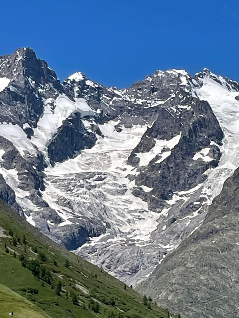
It is a lovely fresh temperature here and the air is so fresh, even if just a little thinner when you walk up a hill. it said it was 17 degrees when we pulled up but it is definitely warmer in the sun with a fresh breeze blowing through. We walked up the nearby hill on our arrival hoping to get a photo of the valley down into Briançon but realised we were the wrong side of the ridge.
We head to the café and had a coffee and then some lunch, our intentions to self cater quickly abandoned when we saw the delicious food coming out to the bikers and cyclists. We were the only ones there not dressed in Lycra or leather 😂
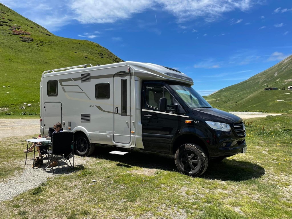
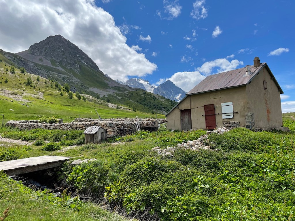
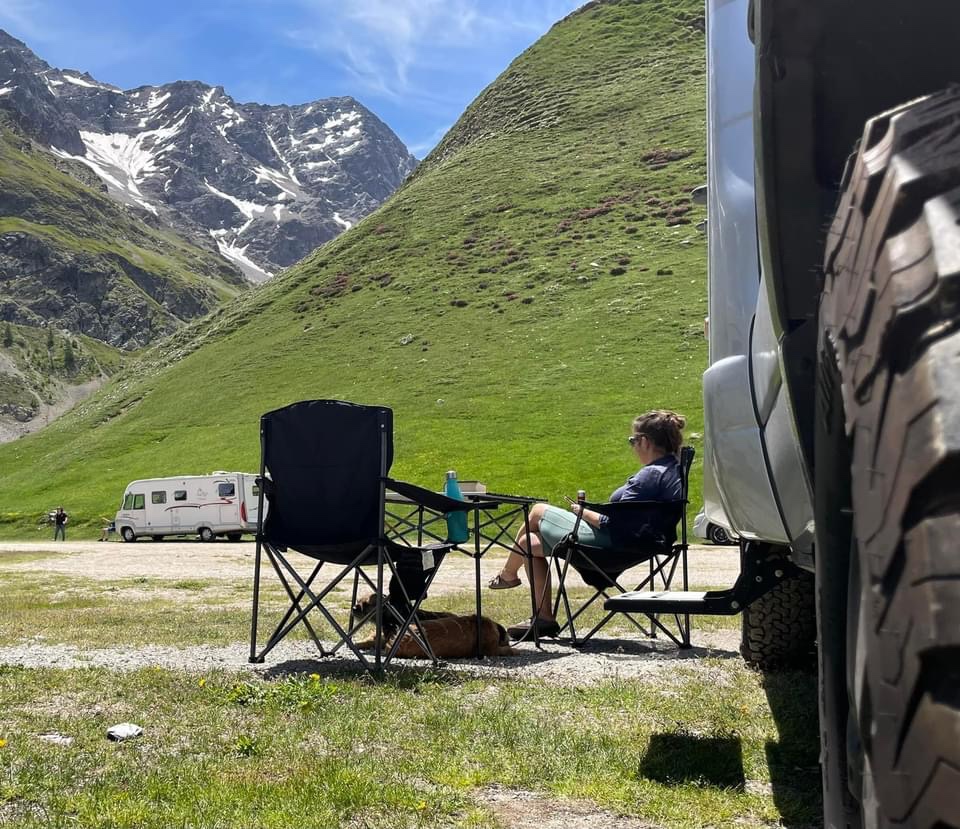
A chat with the Irish proprietor of the hotel who has been up here on the mountain for 12 years confirmed that there was a road closure for the following 2 days but only between 8am and 5pm. So we can either stay here for three days or have an early start one morning to continue our journey. We now have the table and chairs out sat in the sun, just admiring the majesty which are the Alps. We are in no rush to move. I fear our route back to the Eurotunnel by the end of June May consist of the next three weeks in the Alps followed by a rapid long drive north!
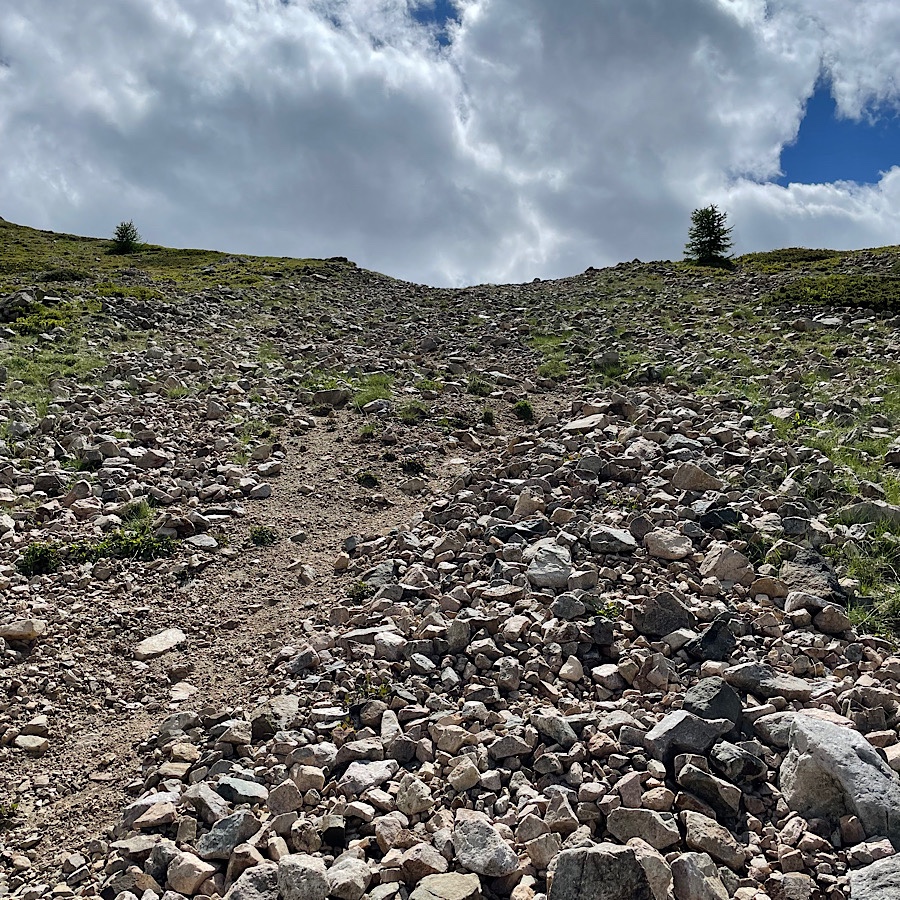
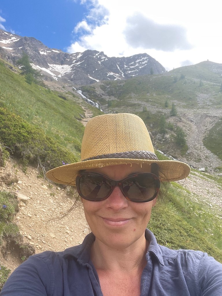
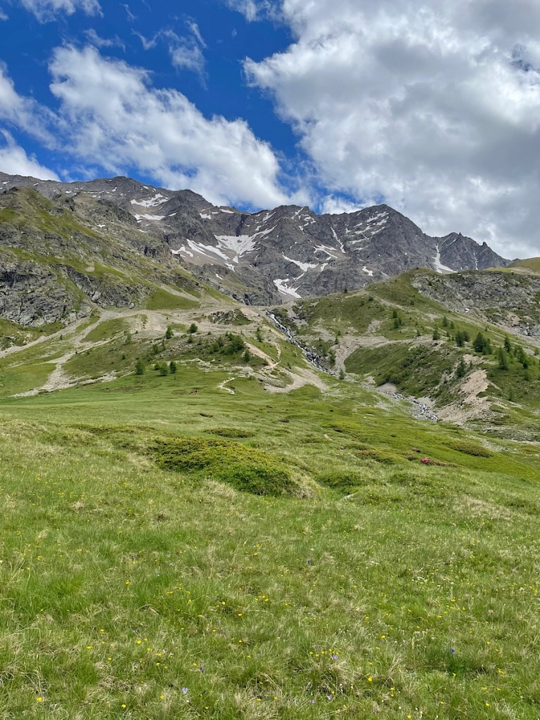
I decided in the afternoon a walk was in order having seen what appeared to be a route round the base of the hill behind us. Kevin and set off with the dogs thinking that we should be following the gravelled track behind us. However, another no dogs sign at the start of the walk said otherwise. Kevin still has a swollen sprained ankle from a twist a couple of days ago, volunteered to head back and dog sit. It turns out that was a good plan, as my apparently flat route from a Google maps satellite image actually involved a fairly steep ascent up a scree slope! The view of the stream falling down the hillside and the glacier behind made it all worthwhile. However, I was terrified of falling and breaking an ankle, wearing walking shoes not boots, no water, no gear with me and having to call the emergency services as the dappy English tourist. So the descent was very very careful and I was back to the van within the hour. I understand now why people have walking sticks on the mountains. Always thought they looked a bit silly particularly when you see them used in the Lake District by people so pristinely clean on the streets of Ambleside that they have clearly just used them to walk to the cafe.